Clarendon, Quebec – GPS Coordinates 45.620943294762526, -76.51775396303526
Our current launch site is in Clarendon, Quebec – just west of Shawville in the Pontiac Region. The sites are large enough for model and mid-power flights. A Tripoli Rocketry Association insurance certificate has been issued for us to launch at these sites, so all launch participants over the age of 18 must show proof of current TRA membership to launch at these sites.
The sites are “Site A”, Site “B”, and Site “C” respectively. They are situated quite close to one another, but the directions to reach each are a bit different. The directions below are separated into “How to get there”, which are the directions to get you to the area, and the “How to get to Site (A, B or C)”, which tell you how to find the individual field. The launch announcement Go/NoGo email will instruct which site a launch will be held at. So, for example, if the launch announcement is “Launch is a Go for Site A”, you would follow the “How to get there” directions, then the “How to get to Site A” instructions.
The sites are private property. We have a “leave it cleaner than when we got there” policy with respect to our launch sites. Bring a bag for garbage with you, and pick up any trash you see, whether it’s yours or not.
How to get there
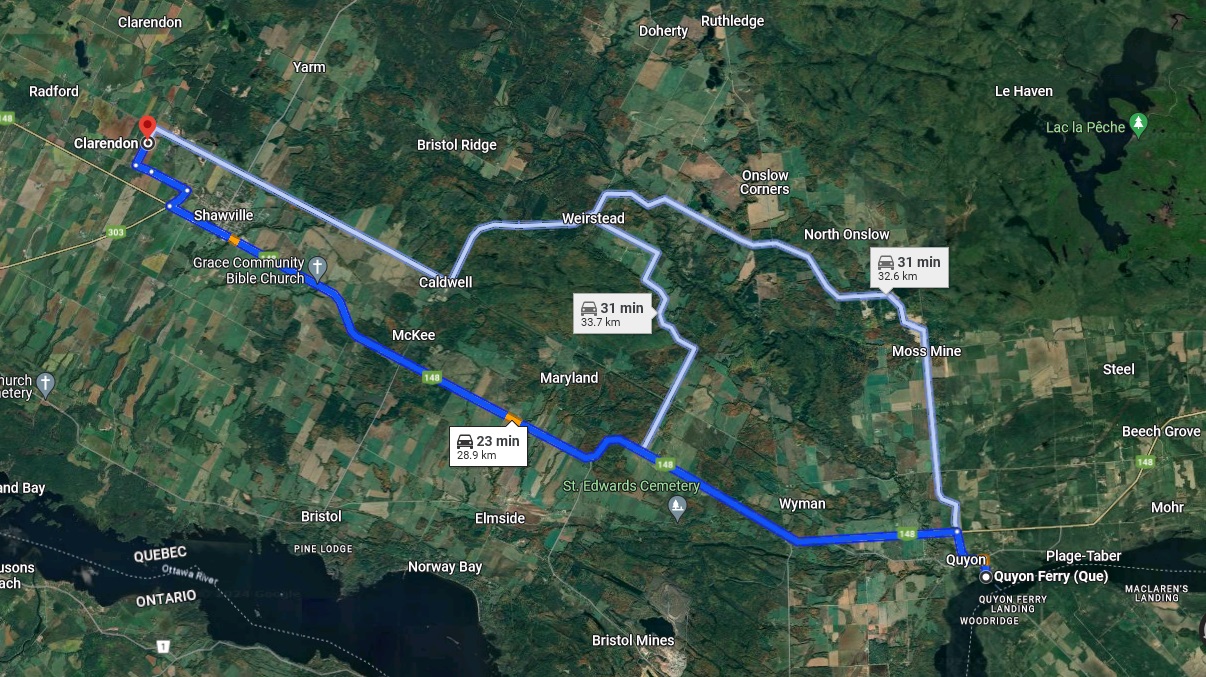
We suggest crossing the Ottawa River via the Quyon Ferry, which is a pleasant ride for only $10 a carload each way. Otherwise, find your way to Quebec Route 148 West, and when you get to Quyon, pick up the below route at step 4 below.
From the Quyon Ferry:
- Head north on Chemin du Ferry (500 Metres)
- Turn left onto Rue de Clarendon (500 Metres)
- Turn right onto Rue Egan to Route 148 West (850 Metres)
- Turn left onto Route 148 West, and drive 24.2 KM
- Turn right on Chemin West (650 Metres)
- Turn left onto Rue John Dale, which will change name to Chemin de Calumet at the Shawville town boundary.
How to get to Site A
- From Chemin West, follow Chemin de Calumet to Rue Moffat (1.6 KM)
- Turn right on Rue Moffat and drive 700 Metres to the launch site on your right.
Click on the map to enlarge it.
How to get to Site B
- From Chemin West, follow Chemin de Calumet for 600 Metres to the dirt road before the red tractor.
- Take the left fork, and follow the dirt road to the top of the hill.
How to get to Site C
- From Chemin West, follow Chemin de Calumet for 2.5 KM to the Little Red Wagon Winery on the left.
- Site C is in the field on the right side of the road, with parking along the side of the road.
Launch dates are posted on the Launch Calendar, please look for updates from time to time.
Check our Groups.io Forum or Facebook Group for the Go/No Go two hours before the launch.

